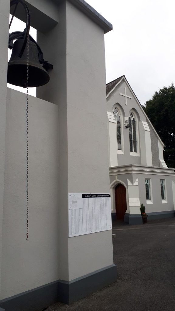
A temporary map and listing of St. John’s graveyard, has been erected in recent days on the Bell Tower at St. John’s Church in time for Blessing of the Graves in Corcreagh this Sunday 14th July 2024.
We hope to have St. Michael’s graveyard map and listing in place for
Blessing of the Graves next week, 21st July 2024, in Corduff.
The following information leaflet will be available at the back of both churches.
St. Michael’s & St. John’s Graveyard Project
Corduff Raferagh Heritage Group is delighted, after several years’ research and effort to finally produce maps and listings for both St. Michael’s graveyard, Corduff and St. John’s graveyard, Raferagh.
Many people helped us along the way, many of whom now rest in both graveyards, but without everyone’s assistance, we would not have been able to reach this stage of our project. At a later date we will acknowledge all who assisted us, but for the moment we are asking for your help in verifying the information on the listings, letting us know of any errors, omissions or additional information.
The information provided on the listings were compiled from
- The inscriptions on the headstones.
- Information forwarded by families and individuals.
- Extensive research of the old newspaper archives to identify funerals & burials that took place in both graveyards.
- Research of the Civil Records on irishgenealogy.ie
Please Note that spellings of Christian names, surnames, townlands etc often vary on headstones and in historical documents. For this project we have selected the townland spellings used on the Ordnance Survey maps, to help us standardise and simplify sorting etc. Dates are often incorrect on headstones, but for this, the first phase of our project we have not changed the dates from what was inscribed on the headstones.
Both graveyards have been divided into areas, to narrow down the physical search area.
St. John’s – Areas A & B, is the area to the left of the church, B coming right over to the path up to the grotto. Area C, D & E is to the right of the church, from the gate right up to the grotto.
St. Michael’s – Areas A, B, C & D, are the main area of the graveyard to the left of the driveway up to the church.
Area E is the top corner heading up the mountain path. F & G are the areas at the back of the chapel. H starts with Dean O’Connor’s grave at the top of the avenue and the graves in front of the side door and heading around towards the vestry.
The New Graveyard is identified as NG with each row having a letter of the alphabet, starting with the first row nearest the road e.g. NGA (New Graveyard, row A), right up to the top row which is NGN. Each individual plot in each row is identified with number 01 to 17, starting with 01 nearest the graveyard driveway.
Many ‘Green Spaces’ or ‘Unknown’ comments are recorded on the listings. Some of these are truly Green spaces that we know have never been used, but some may have been used, so we would ask you to let us know, if you have some information about any of these spaces. In St. Michael’s, in particular, many of the areas identified as Unknown, are obviously graves, given the contours on the ground, these graves have a # after the plot number on the map. We have allocated numbers to many of these Green Spaces or Unknowns, in the hope of someone forwarding information to us. Graves with a surround are identified with a box around the number on the map. Graves with a headstone or Cross and no surround are identified with a +. In St. Michael’s old graveyard, a number of families have come forward with information on burials which took place in the green area at the bottom of the graveyard, nearest the road, but they are unable to say exactly where the plot was located, these graves we have recorded as ULNR – Unknown Location Near Road. Others have identified approximate grave locations throughout both graveyards, these graves have been identified with an * after the plot number. Many people have come forward with names of people they know are buried in the graveyard, but do not know the location of the grave, this type of information is recorded as ULOC – Unknown Location on the listing.
Some headstones have a family name and possibly a townland, where possible we have tried to identify the last known members of the family who were buried here and added their details to the listings.
Our local graveyards are by no means unique in that graves and burials were generally not recorded right across Ireland. Such information was only recorded in the larger towns or city graveyards, or if a diligent clergyman or sexton recorded the info. We are often asked about such information and have to explain this. Also we are cognisant that many families could not afford grave markers, even into late 1900s, which is one of the reasons that it is difficult to identify grave locations.
We still have a number of names which we found on the Newspaper obituaries that we cannot associate with a specific grave. If you can help us out to identify a specific plot for any of the following please get in touch (contact details below).
| Graveyard | Surname | Name | Townland | Day | Mth | Yr |
| St. Michael’s | Murray | James | Corbane | 17 | 07 | 1958 |
| St. Michael’s | Keenan | Laurence | Sreenty | 13 | 10 | 1982 |
| St. Michael’s | McEneaney | Mary Ann | Corkashybane | 27 | 01 | 1969 |
| St. Michael’s | McEneaney | Julia | Corkashybane | 25 | 10 | 1963 |
| St. John’s | Hand | Patrick | 30 | 4 | 1959 | |
| St. John’s | Hand | Elizabeth | Northlands? | 31 | 5 | 1973 |
| St. John’s | McCaul | Edward (Ned) | Shankill, | 1 | 12 | 1956 |
| St. John’s | McDonald | James | Ouvry | 31 | 8 | 1960 |
| St. John’s | McEnaney | Patrick | Carrickadooey | 14 | 4 | 1968 |
| St. John’s | McEnaney | Julia | Ballytrain | 13 | 5 | 1964 |
| St. John’s | McConnon | Peter | Greagh | 1 | 3 | 1963 |
| St. John’s | Lynch | Brigid | Ballybay & CMX | 12 | 2 | 1972 |
| St. John’s | McEnaney | James | Lisseril | 12 | 1 | 1977 |
| St. John’s | McCluskey | Unreadable | Corcreagh | 21 | 3 | 1989 |
| St. John’s | McCaul | Peter | Lisnadara | 10 | 3 | 1988 |
| St. John’s | Finnegan | Thomas | Ardragh | 25 | 3 | 1963 |
| St. John’s | Finnegan | Peter | Ardragh | 19 | 12 | 1973 |
You can appreciate that extensive work has gone into this project, and every effort has been made to provide accurate information, but these maps and listings are by no means definitive and should be treated as a nonprofessional, voluntary project, our aim is to assist, not cause controversy or annoyance if we have recorded information or identified graves incorrectly please let us know ASAP.
The next phase of this project is to record all this information in a booklet format, along with other information which we are in the process of gathering such as the maiden names of the ladies who rest in our graveyards and where they came from. We also have in some cases gathered trades, professions, or anecdotes about the families as well as where the families lived, concentrating mainly on those families who no longer live in the area. So by reviewing and correcting the information on the maps and listings this will eliminate such errors when we go to print our booklet.
We thank you for your help with this project.
Correction Forms will be provided at the back of both churches for anyone to fill with corrections or omissions. You can place these completed forms in the box provided at the back of both churches. Alternatively, you can email the heritage group on corduffraferaghheritage@gmail.com or text the information to Bernie on 087 9555762.